Explore my GIS and spatial analysis projects showcasing applied skills in public-sector GIS, transportation analysis, remote sensing, dashboard development, field data collection, environmental mapping, and cartographic design. These projects demonstrate my ability to analyze real-world spatial problems, organize geospatial data, create interactive maps, and communicate results through professional maps, dashboards, and visualizations.

Atlanta Citizen Review Board (ACRB) Allegations Dashboard
As part of my GIS internship with the City of Atlanta Department of City Planning, I worked on an ACRB Allegations Dashboard project designed to organize, clean, map, and visualize complaint-related records for public-sector decision support. The project involved preparing incident data, standardizing allegation categories, handling records with multiple allegations, geocoding missing locations, configuring web maps, and building dashboard elements such as filters, selectors, indicators, lists, pop-ups, and map-based visualizations.
Project Objectives
- Organize and clean ACRB complaint and allegation records for GIS dashboard use.
- Standardize allegation categories and handle records with multiple allegations.
- Geocode incident locations and prepare spatial data for mapping.
- Build an interactive public-facing dashboard to support transparency, spatial exploration, and reporting.
- Improve access to location-based complaint patterns through filters, indicators, lists, pop-ups, and map-based visualization.
Key skills & tools:
ArcGIS Online, ArcGIS Dashboards, web mapping, data cleaning, geocoding, attribute management, public-sector GIS, dashboard design, spatial visualization, Excel, cartographic communication
Key Contributions:
- Data cleaning and standardization.
- Geocoding and spatial validation.
- Dashboard design and configuration.
- Interactive filtering by:
- Year
- Allegation Type
- Council District
- Police Zone
Deliverables
Interactive Dashboard, Web Map, Data Standardization Framework, Spatial Reporting Tool
Result Statement:
This project strengthened my ability to move from raw tabular records to a functional GIS dashboard that supports clearer exploration of complaint patterns, location-based trends, and administrative reporting.
Status:
Completed

Environmental & Transportation Risk Mapping Using GIS (Ongoing)
This ongoing project applies GIS and spatial analysis techniques to evaluate environmental hazards and their impacts on transportation infrastructure. Using raster and vector datasets, I analyze flood and erosion risk, overlay road networks, and identify vulnerable areas to support transportation safety and planning decisions.
Key skills & tools:
ArcGIS Pro, spatial overlay, raster analysis, transportation GIS, hazard mapping, cartographic design
Status:
Ongoing

Remote Sensing Change Detection Using NDVI (Deepwater Horizon Case Study)
This project applies remote sensing techniques to analyze environmental change using NDVI derived from multi-temporal Landsat imagery following the Deepwater Horizon oil spill. I performed image preprocessing, vegetation index calculation, and time-series comparison to assess spatial patterns of vegetation stress and recovery. The project demonstrates my ability to work with satellite data, apply raster-based analysis, and interpret environmental impacts using GIS.
Key skills & tools:
ArcGIS Pro, Landsat imagery, NDVI, raster analysis, change detection, environmental remote sensing
Status:
Completed

NDVI maps comparing pre- and post-spill conditions, highlighting areas of vegetation/water stress and recovery.
Red areas indicate NDVI loss associated with oil-affected zones, while green areas represent vegetation recovery over time.
Transportation & Road Safety Spatial Analysis
This project applies GIS and spatial analysis to assess transportation safety by examining how flood and erosion hazards impact road infrastructure. Using FEMA flood hazard data, terrain-derived erosion indicators, and road network datasets, I performed spatial overlays to identify road segments exposed to environmental risk. The resulting maps highlight vulnerable transportation corridors and demonstrate how GIS can support road safety assessment, infrastructure planning, and hazard-informed decision-making.
Key skills & tools:
ArcGIS Pro, transportation GIS, FEMA NFHL data, road network analysis, spatial overlay, raster analysis, hazard mapping, cartographic design
Status:
Completed
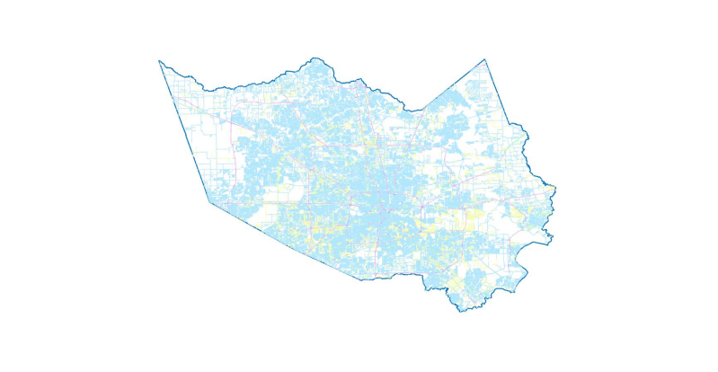
Transportation risk map highlighting road segments intersecting hazard-prone areas (Harris County, TX). The analysis was conducted for Harris County, Texas, using publicly available transportation and hazard datasets.
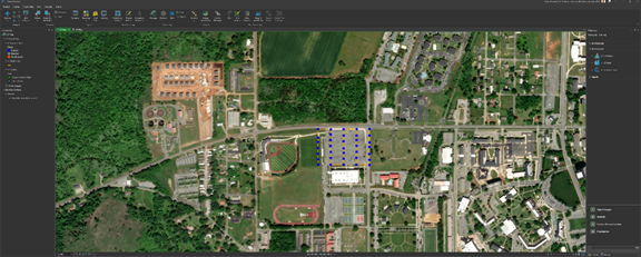
Field and Asset Data Collection Integrated with Transportation Safety Analysis
This project focuses on collecting, validating, and integrating field-based and asset-related GPS data into a GIS environment to support transportation safety analysis. Using handheld GPS and field survey techniques, I captured spatial features and attributes, verified positional accuracy, and incorporated the data into ArcGIS Pro for mapping and analysis. The project demonstrates my ability to bridge fieldwork and desktop GIS workflows.
Key skills & tools:
GPS data collection, field surveys, ArcGIS Pro, data validation, geodatabase creation, spatial data integration
Status:
Completed


Field data were collected, processed, and integrated into applied GIS mapping exercises.
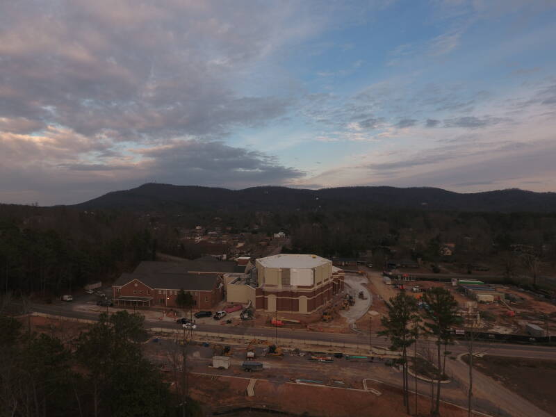
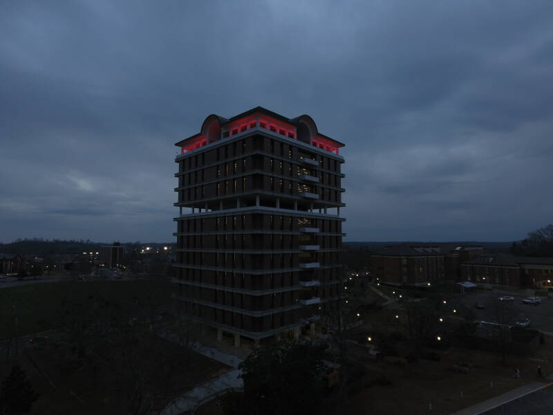
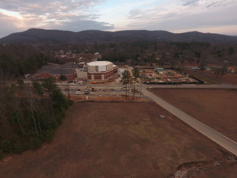
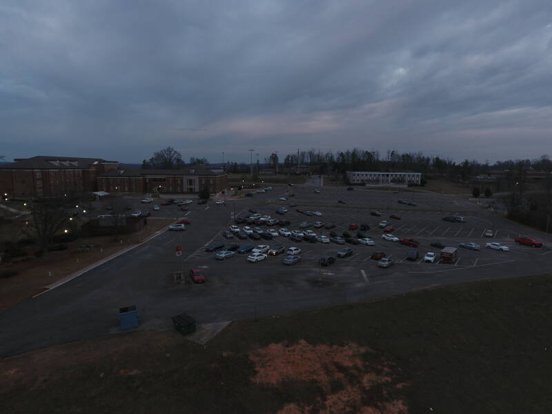
Drone-Based Mapping & Orthomosaic Analysis
This project applies unmanned aerial systems (UAS) and GIS techniques to collect high-resolution aerial imagery for site-level mapping and analysis. Using drone-acquired images, I generated orthomosaics and spatial products to support surface assessment, infrastructure inspection, and spatial visualization. The project demonstrates my ability to integrate drone data into GIS workflows for practical decision-making.
Key skills & tools:
Drone data collection (UAS), orthomosaic generation, ArcGIS Pro, spatial visualization, image interpretation, field-to-GIS integration
Status:
Completed
Drone flights and orthomosaic mapping conducted for academic GIS coursework and applied spatial analysis.

High-resolution drone orthomosaics generated and integrated into ArcGIS Pro for site-level mapping, spatial analysis, and visualization.
Contours, TINS, and 3D Imagery
Drone Flight Images
Create Your Own Website With Webador