Applied GIS Skills
This page highlights my core GIS skill sets, demonstrated through applied coursework, research projects, and real-world experience with the City of Atlanta Department of City Planning. My skills support public-sector GIS, transportation analysis, environmental mapping, remote sensing, dashboard development, field data collection, and spatial decision support.

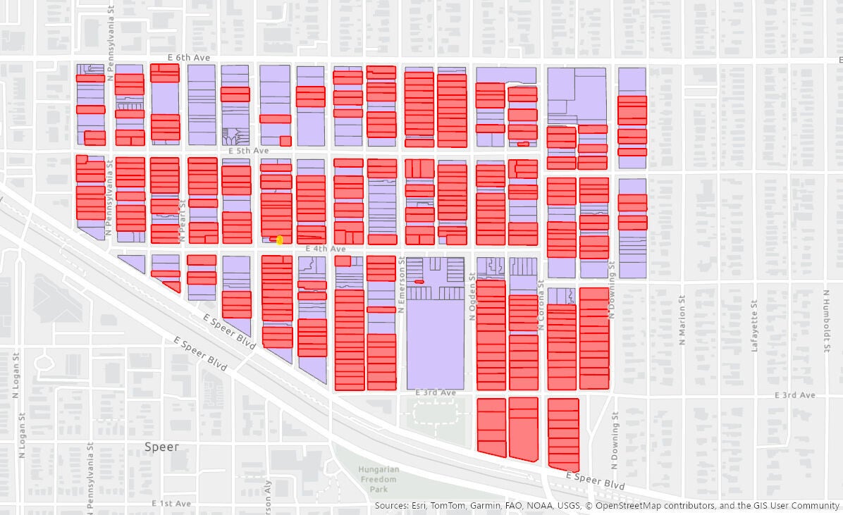
ArcGIS Dashboards & Public-Sector GIS
Hands-on experience creating public-sector GIS dashboards using ArcGIS Online and ArcGIS Dashboards. Skilled in preparing tabular data for mapping, standardizing attribute fields, geocoding missing locations, configuring web maps, creating selectors and filters, designing indicators and lists, and developing dashboard layouts that support data exploration and decision-making.

ArcGIS Pro & Spatial Analysis
Proficient in vector and raster spatial analysis, including overlays, hazard mapping, and data integration workflows. Skills demonstrated through real project applications supporting transportation safety and environmental analysis using ArcGIS Pro.

Transportation GIS & Road Safety Risk Mapping
Applied experience in transportation GIS and road safety risk mapping, including analysis of road networks intersecting flood and erosion hazard zones. Projects demonstrate GIS support for infrastructure planning, safety assessment, and hazard-informed decision-making.

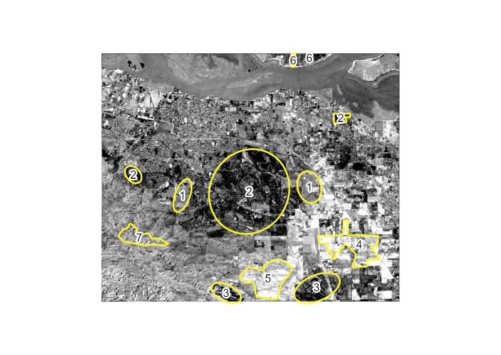
Remote Sensing & Change Detection
Experience in remote sensing analysis using Landsat imagery, including NDVI time-series and change detection workflows. Applied to environmental impact assessment and recovery analysis using raster-based GIS techniques.

UAS / Drone Mapping & Orthomosaic Analysis
Experience in UAS/drone-based mapping, including flight planning, orthomosaic generation, and site-level spatial analysis. Projects integrate drone imagery into ArcGIS Pro workflows for visualization, inspection, and decision support.
Field Data Collection & GPS Mapping
Experience in field-based GPS data collection, validation, and geodatabase integration. Applied in mapping exercises to ensure spatial accuracy, data reliability, and seamless field-to-desktop GIS workflows.
GIS Cartographic Design & Map Production
Proficient in cartographic design and professional map layout creation using ArcGIS Pro. Demonstrated through clear, publication-ready maps that effectively communicate spatial patterns, hazards, and analysis results. Emphasis on visual hierarchy, legend design, symbology, and layout standards for technical and decision-support maps.
Create Your Own Website With Webador